The Assessment, Inventory and Monitoring (AIM) Strategy provides a set of standards for assessing natural resource conditions and trends on BLM-managed public lands. The AIM Strategy provides quantitative data and tools to guide and justify policy actions, land uses and adaptive management decisions.
Guides monitoring program development, implementation, and data use for decision makers. AIM monitoring starts with identifying clear management questions to inform when, where, and how often to collect data. This and all other steps of AIM implementation are supported by a network of subject matter experts including State Leads, Monitoring Coordinators, and the BLM National Operations Center. Collectively, the AIM Team provides practitioner support with:
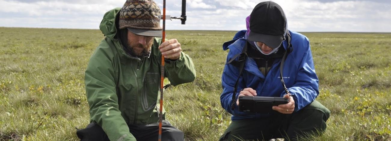
Allows data comparisons through space and time in support of multiple management decisions. AIM field methods were developed by a network of BLM experts and partners. The objectives were to ensure usable and defensible data for the BLM, while also standardizing monitoring efforts across agencies and jurisdictions. These dual objectives were achieved by adopting field methods used and tested by multiple agencies and partners throughout the western U.S. and Alaska.
Terrestrial – Designed for upland habitats, the terrestrial methods provide comprehensive information on rangeland vegetative and soil conditions.
Lotic – Designed to provide quantitative data for wadable streams and rivers on all BLM lands.
Riparian and Wetland – Designed for riparian areas, floodplains, and wetlands, the Riparian and Wetland data bridge the information gap between terrestrial and lotic areas.
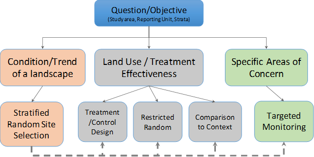
Minimizes bias and maximize inference of collected data. BLM is actively using the AIM Strategy to inform management decisions at multiple spatial scales from individual restoration projects on up to national level reporting. The AIM Team at the BLM’s National Operations Center provides technical support for the development of appropriate sample designs to match monitoring objectives from targeted sampling to spatially balanced, random sampling.
Ensures data quality, accessibility, and use. AIM data are collected using mobile applications, stored in a centralized BLM repository and available to users via web portals and spatial data services. Mobile applications allow for greater integration of QA & QC practices while also making data available quickly. Centralized data storage gives users the ability to analyze AIM data independently or with developed tools supplied by the program.
Integration with Remote Sensing
Optimizes sampling and calibrate continuous map products. Remote sensing datasets are another way that AIM data informs land management decision-making. For example, LANDFIRE products map vegetation types and many fire-related landscape attributes (https://landfire.gov/data_overviews.php). Fractional vegetation cover maps are increasingly available as well, including RAP (https://rangelands.app/), LandCART (https://landcart.org ), RCMAP Viewer (https://www.mrlc.gov/rangeland-viewer/), Near-Real-Time Cheatgrass (https://www.usgs.gov/centers/eros/science/near-real-time-cheatgrass-monitoring), and more. Practical advice for applying these products in decision-making is available from Allred et al. 2020 and BLM TN456.
Rapid advancement of remote sensing technology combined with on the ground AIM data provides land managers with tools related to:
Standard workflows empower land managers to make defensible decisions regarding multiple uses of rangeland ecosystems sustained through time. Ideally, workflows consider the full suite of standard datasets that support decision-making, including supplemental indicators, permitted uses, and natural disturbances. They also foster co-production of knowledge by integrating multiple knowledge types. Workflows have been developed for wildlife habitat (cite HAF), land health evaluations (cite TN453), and more.